STARRY PATH CHEMIN DES ÉTOILES
Wachenheim on the wine route
On the paths of the pilgrims of St. James
Haardt axis
Wachenheim an der Weinstraße belongs to the catchment area of the so-called “Haardt axis” and is located about 14 km of the signposted paths of the pilgrims of St. James along the Palatinate | North route. From a cultural-historical point of view, the Haardt axis represents another alternative of the medieval path axes of the pilgrims of St. James from Worms in the direction of Strasbourg in Alsace.
This imaginary axis stretches along the edge of the Haardt via Bad Dürkheim, Neustadt, Landau, Bad Bergzabern to Wissembourg. Along the way, there is a multitude of testimonies to medieval building culture to be discovered, which have been recorded as part of the “Sternenweg”. Important monasteries, such as the Limburg Monastery, mark an imaginary connecting axis here to the present day, which has not yet been officially designated and marked. Within the project space “Starry Path/
Among these gems are the medieval cultural monuments of Wachenheim:
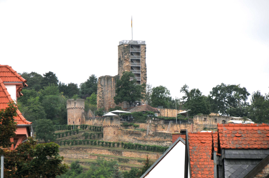
Wachtenburg castle ruin
N49° 26’ 10.33", E8° 10’ 21.32"
12. Century
Remains of the former city fortification
15. Century
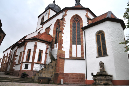
Ensemble simultaneous church of St. George
N49° 26’ 18.26", E8° 10’ 53.27"
Eastern part (15th c.), remains of medieval wall paintings, south of it “Ludwigskapelle” (15th c.)